Remote Sensing Technologist

Remote Sensing Technologist
Job Sector
Energy and Natural Resources
Potential Salary (USD)
Low End: $40,000.00 /yr
Avg/Med: $70,000.00 /yr
High End: $125,000.00 /yr
Education Required
- Bachelor of Science in Geographical Sciences, or
- Bachelor of Science in Environmental Engineering, or
- Bachelor of Science in Geography with Remote Sensing and GIS concentration.
Job Outlook
The demand for Remote Sensing Technologists is expected to grow as industries increasingly rely on geospatial data for environmental monitoring, resource management, and disaster response.
Career Profile Overview
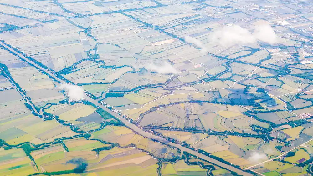
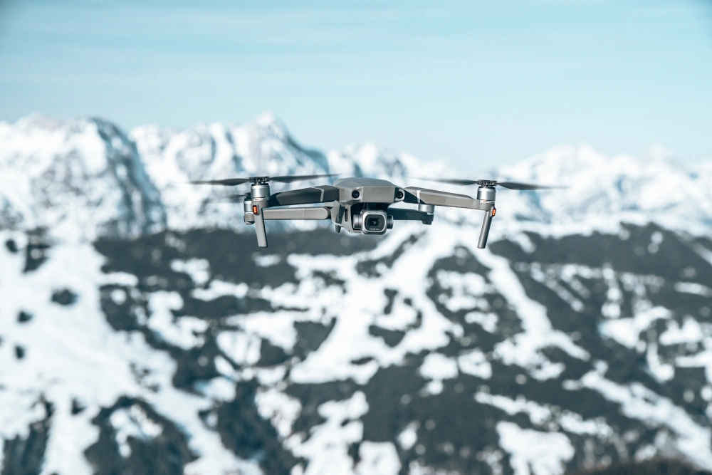
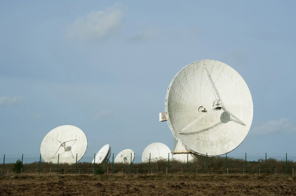
A Remote Sensing Technologist specializes in the collection and analysis of data from remote sensing technologies, such as satellites, drones, and aircraft. This data is used to monitor environmental changes, manage natural resources, and support various scientific and industrial applications. Remote Sensing Technologists play a crucial role in understanding large-scale environmental phenomena and informing decision-making in fields like agriculture, forestry, climate science, and urban planning.

Key Responsibilities
Data Collection
- Operate and manage remote sensing equipment, including satellites, drones, and aerial cameras, to gather data about the Earth’s surface and atmosphere.
Data Processing
- Use specialized software to process and analyze remote sensing data, converting raw images and sensor readings into actionable information.
Image Interpretation
- Analyze satellite and aerial imagery to identify patterns, monitor environmental changes, and assess land use.
Geospatial Analysis
- Combine remote sensing data with Geographic Information Systems (GIS) to create detailed maps and models that can be used for environmental monitoring, disaster management, and resource management.
Research and Development
- Collaborate with scientists and engineers to develop new remote sensing technologies and applications.
Project Management
- Manage remote sensing projects from planning through execution, including data collection, analysis, and reporting.
Environmental Monitoring
- Use remote sensing data to monitor environmental conditions, such as air and water quality, vegetation health, and climate change impacts.
Educational Path
High School
- Basic understanding of science, mathematics, physics, and electronics is important for this role.
Postsecondary
Bachelor’s Degree in Remote Sensing, Geography, Environmental Science, or a Related Field
Advanced Degrees
Master’s or Ph.D. in Remote Sensing, Geospatial Science, or a Related Field
Certifications
- Certified Mapping Scientist, Remote Sensing (CMS-RS)
- GIS Certification
Entry-Level
Remote Sensing Technician
- Operates remote sensing equipment, collects raw imagery and data, and performs initial processing and quality checks under supervision.
GIS Technician
- Digitizes, organizes, and maintains geographic data within a Geographic Information System (GIS), creating maps and basic spatial analyses.
Environmental Data Analyst
- Collects, cleans, and performs preliminary analysis on environmental datasets, often including those derived from remote sensing, to identify trends or issues.
Mid-Level
Remote Sensing Specialist
- Processes, interprets, and analyzes complex remote sensing data (e.g., satellite imagery, LiDAR) to extract meaningful information for various applications.
Geospatial Analyst
- Applies advanced GIS and remote sensing techniques to perform spatial analysis, develop models, and create sophisticated maps and visualizations to solve problems.
Environmental Consultant
- Utilizes remote sensing and GIS tools to conduct environmental impact assessments, site analyses, and provide expert advice on natural resource management or remediation projects.
Senior-Level
Senior Remote Sensing Technologist
- Leads complex remote sensing projects, develops advanced processing workflows, innovates new applications of remote sensing data, and mentors junior staff.
Remote Sensing Scientist
- Conducts research and develops novel algorithms and methodologies for acquiring, processing, and interpreting remote sensing data, often publishing findings.
Geospatial Project Manager
- Oversees all aspects of geospatial projects, including remote sensing and GIS components, managing teams, budgets, schedules, and client communication from inception to completion.
Skills and Qualities
Technical Skills
- Strong understanding of remote sensing technologies, including satellite systems, aerial imagery, and sensor operations. Familiarity with data processing software and GIS tools.
Data Analysis
- Meticulous in data processing and analysis to ensure accuracy and reliability of results.
Communication
- Effective in presenting technical information clearly and concisely to diverse audiences, including scientists, policymakers, and the general public.
Teamwork
- Ability to work in interdisciplinary teams, combining expertise from different fields to achieve common goals.
Organization
- Strong organizational skills to manage projects, timelines, and resources effectively.
United States
University of Maryland | Maryland
- Program: Bachelor of Science in Geographical Sciences with a focus on Remote Sensing.
- Website: UMD Geographical Sciences
University of Southern California | California
- Program: Bachelor of Science in GeoDesign with coursework in Remote Sensing and Spatial Analysis.
- Website: USC Architecture
University of Colorado Boulder | Colorado
- Program: Bachelor of Science in Environmental Engineering with a Remote Sensing Track.
- Website: CU Boulder Environmental Engineering
Canada
University of Waterloo | Ontario
- Program: Bachelor of Environmental Studies in Geography and Environmental Management with a specialization in Remote Sensing.
- Website: UWaterloo Geography and Environmental Management
University of Calgary | Alberta
- Program: Bachelor of Science in Geography with a concentration in Geospatial Technologies.
- Website: UCalgary Geography
Simon Fraser University | British Columbia
- Program: Bachelor of Science in Environmental Science with a Remote Sensing and GIS Concentration.
- Website: SFU Environmental Science
Compton J. Tucker
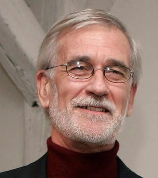
Position
Earth Scientist, Senior Scientist at NASA’s Goddard Space Flight Center
Contributions
Dr. Compton J. Tucker is a pioneering scientist in the field of remote sensing, known for developing the Normalized Difference Vegetation Index (NDVI), a key tool used to monitor vegetation globally. His work has been instrumental in understanding global climate change, deforestation, and the health of ecosystems through satellite data.
Impact
Tucker’s contributions have revolutionized the way scientists monitor Earth’s ecosystems, allowing for more accurate tracking of climate change impacts on vegetation and helping to inform conservation efforts worldwide.
Source

Resources and Further Reading
- National Aeronautics and Space Administration: NASA Remote Sensing
- European Space Agency: Eduspace, Marine Litter